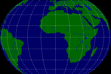
Geoc aims to provide a very small and simple set of API's to assist the developer in creating geographically referenced canvas applications within the GTK-2 environment.
Geocvpf is an additional library that is used to render Vector Product Format including Digitial Nautical Charts.
The geoc library is built on crcanvas. The API is a simplified and reduced version of the original geocanvas API. Performance in some cases can be worse than with geocanvas due to differences in the underlying rendering libraries. The packages include a GeocLinesFaster canvas item that paints using GDK drawing commands instead of Cairo which can bring it back to geocanvas levels when it is necessary to draw lots of polygons.
Download geoc. (geoc depends on crcanvas)
View Python Example Program (included in package)
Geovpf provides a GObject interface that is used to plot Vector Product Format (VPF) onto the GeocCanvas. VPF is a geo-relational format developed by the National Geospatial Intelligence Agency. It is specified by MIL STD MIL-STD-600006. VPF is the format used in Digital Nautical Charts.
Download geocvpf. (geocvpf depends on geoc and crcanvas)